Projects
A selection of my geospatial projects. Click any card to see the full write-up.
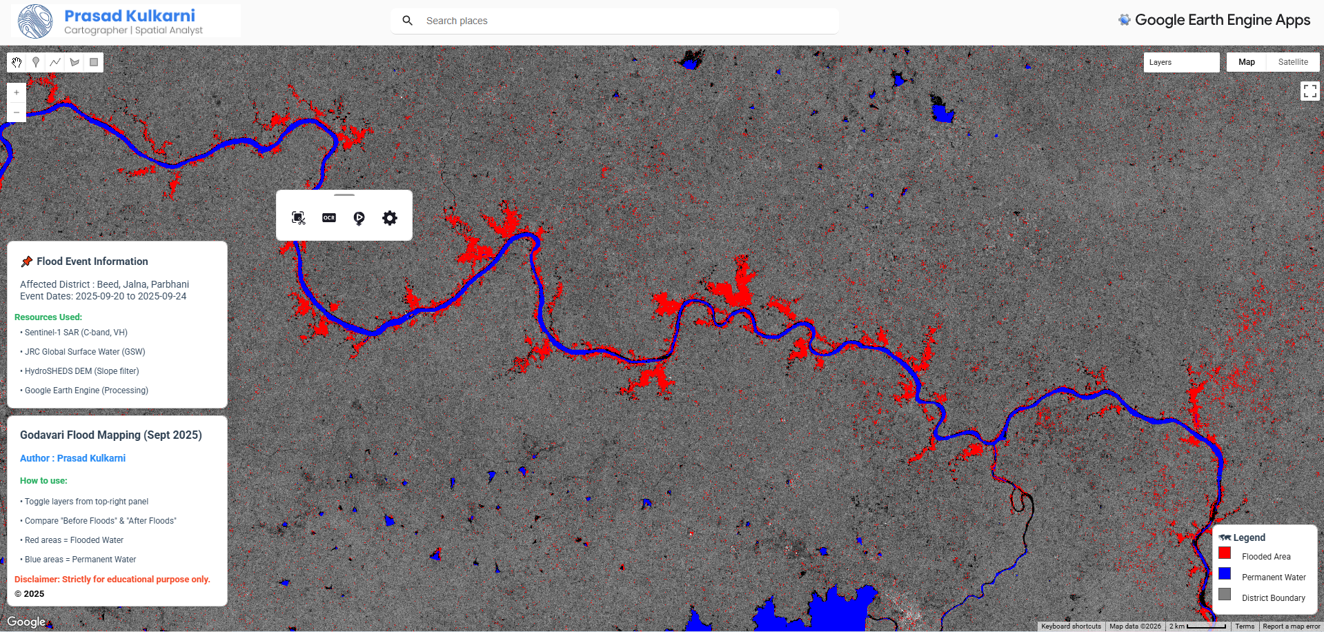
This project utilizes satellite remote sensing to map and analyze the severe flooding events in the Godavari River basin during 2025.
GEE GEE User Interface (ui) API Sentinel-1 SAR
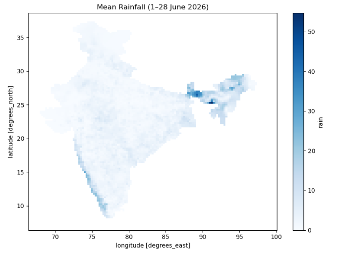
This project demonstrates how to download gridded rainfall observations from the India Meteorological Department (IMD) using the imdlib Python package.
Python pandas imdlib